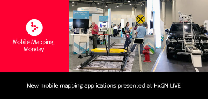
This year HxGN LIVE took place at The Venetian Hotel in Las Vegas. On Tuesday, June 13 the conference started with Hexagon President and CEO Ola Rollén’s keynote address, an inspiring presentation that gave our 3000 attendees a good taste of what would follow the next three days.
A look at the mobile mapping presentations
This year’s conference had a multiple day dedicated mobile mapping track, which gave our customers and colleagues the opportunity to talk about their successful projects, case studies, and innovations with our product. Here are a few highlights:
Road Infrastructure – Mobile LiDAR for Feasibility Planning and Development
Mobile LiDAR feasibility studies of roads and highways are designed based on road function, type and volume of expected traffic, potential traffic hazards and safety standards, capital cost, maintenance costs, vehicle operating costs, environment impacts, aesthetics, as well as, convenience of the road users. Geometric features need to be accurately measured and mapped. Genesys International pioneered the use of LiDAR in various infrastructure projects in India and presented the case study.

Reality Capture Workflows for the Pegasus:Backpack – Taking Data Into Simulation or Gaming Solutions
The past few years have seen the convergence of 3D graphics technology in the video game and film industries. Many visual effects studios use game engines to pre-visualise effect shots to reduce back-end costs in post-production while game engines have recently added high end rendering techniques previously only seen in blockbuster films. This presentation examined the current pipelines used in games and film production to visualise industrial scan data on a large scale with a short turnaround using the new Leica Pegasus:Backpack.

Mobile Mapping for the Masses – Pegasus data in Cyclone and CloudWorx
As Reality Capture continues to evolve, the barriers between foundation software crumble and software on your system today can be used for dynamic mapping. This session demonstrated the capabilities of using traditional static scanning software, Cyclone, Cloudworx, 3D Reshaper, and others, for processing, feature extraction and publication of mobile mapping data. Frank Collazzo and Brad Adams, our colleagues at Leica Geosystems, did a live 30 minutes demo using all the above mentioned software to visualise the data captured with the Leica Pegasus:Backpack, and made it look like child’s play.
Shoreline Monitoring and Shoreline Protection Using a Mobile Mapping System on a Boat
Matthew Art, Chief of Operations at E4 Sciences presented shoreline monitoring and shoreline protection using a Mobile mapping system on a boat. He demonstrated how mobile mappings systems keep his staff safe, by getting them in and out of hazardous zones very quickly, whilst capturing more data than with traditional methods.
Meeting the technology at The Zone
The Zone, which was a showcase of smart initiatives and innovation, exhibited over more than 120,000 square feet and demonstrated Hexagon’s capacity to offer complete and efficient solutions for every industry they serve.

With Leica Geosystems’ Pegasus:Two and SiTrack:One, we digitise highways and rail networks. We extract assets with SiRail, SiRoad, and MapFactory software which enable our transport networks to conduct maintenance and build. The Leica ProScan enables TPS tracked high accuracy reality capture for manufacturing environments. We provide the positioning solutions over whole countries with SmartNet services.
It was a great event and we would like to thank all mobile mapping presenters for making every session interesting and diverse, and for sharing their experience in using the Leica Geosystems products. It was a great opportunity to show on real life examples how user-friendly, flexible, helpful, cost and time effective the mobile mapping products are.


