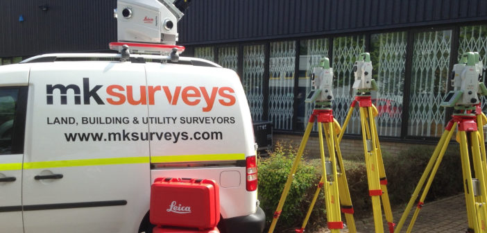
MK Surveys acquires first mobile mapping platform in Leica Pegasus:Two
Recently, mobile mapping arrived at the offices of MK Surveys in the form of the Leica Pegasus:Two. The complete mobile mapping solution from Leica Geosystems provides an integrated hardware platform including cameras and LiDAR. Along with increasing their total station fleet with six Leica Captivate TS16 Robotic Kits, MK Surveys has invested in the Pegasus:Two along with Leica Jetstream to enable both rapid acquisition of the data on site and enhanced data processing speed.
Established in 1972, MK Surveys is an independent survey and mapping company with their headquarters based in Milton Keynes, Buckinghamshire and regional offices in Oxford, East Midlands, West Midlands and Horsham, United Kingdom. MK Surveys provide a cost competitive array of services across the UK and worldwide.

From Left to Right: Dan Grigg, MK Surveys operation manager, Lewis Hook, MK Surveys surveying manager, Shane O’Regan, Leica Geosystems account manager, and Stuart Dimond, MK Surveys director.
Services include:
- Topographical surveys
- Measured building surveys
- 3D laser scanning
- Surveys4BIM
- 3D modelling (CAD / Revit)
- HDR (High Dynamic Range) imagery
- Utility surveys to PAS128 standard
- Adoption surveys
- CCTV drainage surveys
- GIS data capture and asset mapping
“We are delighted with the delivery of the Leica Pegasus:Two and the opportunity mobile mapping presents us,” said Lewis Hook, MK Surveys survey manager. “Previously we would have had to use very conventional methods to survey roads, rail and mass elevation projects. Now with the Pegasus:Two we can comprehensively survey large scale projects far quicker and more efficiently, saving time, reducing costs and improving site safety.”
A world of opportunity
The delivery of the Pegasus:Two will open a whole new world of mobile mapping to MK Surveys whilst using this mobile mapping solution. Revolutionary in design and technology, the vehicle mounted Pegasus:Two mobile mapper will be used by MK Surveys for various infrastructure projects including surveys of highways and rail, as well as GIS data collection and asset management.
The introduction of mobile mapping for MK Surveys has many advantages, including drastically reducing the fieldwork required for highways projects, with no need for road closures or traffic management, as the Leica Pegasus:Two acts in the same way as any other public vehicle. All data is collected remotely from a moving vehicle to survey grade accuracies. Removing the workforce from the road helps improve health and safety on site, whilst providing fast and accurate data.
“As part of our strategy for achieving efficiency gains through mobile data collection, we have been extremely impressed by the speed of collection and quality of data from the Leica Pegasus:Two mobile mapper,” said Stuart Dimond, MK Surveys director. “In 2002, we made what at the time seemed like a major investment in purchasing one of the first Cyrax 2500 laser scanners in the UK. This enabled us to work at the forefront of the laser scanning market. Today we are at the forefront again, with the purchase of the Pegasus:Two mobile mapping solution.”


