The Large Hadron Collider (LHC) is the world’s most complex experimental facility ever built. It first started up on 10 September 2008, and remains the latest major addition to CERN’s (European Organization for Nuclear Research) accelerator complex.
The LHC consists of a 27-kilometre ring of superconducting magnets with a number of accelerating structures to boost the energy of the particles along the way. The beams inside the LHC are made to collide at four particle detectors: ATLAS, CMS, ALICE and LHCb. This scientific instrument has an ambitious purpose: to crack the code of the physical world and identify what the universe is made of.
The SU (SUrvey) Section is responsible for the metrology and alignment of the accelerators, of their associated beam transfer lines and of the detectors, for the whole CERN site. Along the nearly 62 km of beam lines and, for most of the experiments, this relates to the accurate positioning of their components or detectors (“alignment”) and for the maintenance of these geometrical configurations, according to the beam aperture need.
The techniques used come from geodesy and surveying, with some very specific developments – in order to comply with the very high accuracy requirements. Most of the activity is therefore devoted to Research and Accelerator sectors with all relevant contributions in geodetic or photogrammetric metrology, or special methods, if needed, for both infrastructure and equipment. In addition, the SU Section is also responsible for the regular surveying of the site, providing support and maps to various technical or administrative services of CERN (Local Affairs) and its surrounding host states.
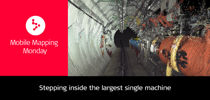
Stepping inside the largest single machine
SU Section staff access to the LHC facilities is limited to very short periods of the year as physicists have priority for use to gaom the longest periods of particle collisions. This time constraint implies that all teams must prepare and plan their interventions as accurately as possible.
A few months ago, SU Section and Leica Geosystems arranged a demonstration to show the latest kinematic technology and possible application studies for CERN equipment.
To date, the most important areas of the LHC have been completely digitised using Leica ScanStations, making it possible to optimise integration studies and modification of services (conflict studies, etc.). However, like all installations of this scale, the environment is constantly changing: new networks, cables, collimators, magnets, detectors are installed, nothing is fixed in time. This information needs to be updated quickly and accurately. It was in this context that Leica Geosystems intervened to present two kinematic solutions to the section: the Leica Pegasus:Backpack and the Leica ProScan.

View in Pegasus Manager of cables in point cloud and pictures
The data acquisition with the Pegasus:Backpack was done by initialising the system indoor at 100 m below the ground level; 400 m were acquired in less than 15 min including the initialisation phases. The flashlight system was active in order to achieve the best quality for the pictures. Control points were inserted at fiducial marks located on LHC components for post processing of the point cloud and pictures in the local coordinates system.

View of HDS targets used to set the project in local coordinate system
The acquisition with the ProScan was done by setting up a Leica TS16 total station on reference points to work directly in the local coordinate system. The TS16 tracked and recorded every 0.2s the position of the Leica ProScan during the kinematic scanning phase; 60 m were measured in less than 8min. The calculation was done on the same day and presented the following day to CERN’s SU Section staff.

View of HDS targets used to set the project in local coordinate system
The Leica Pegasus:Backpack and the Leica ProScan received positive feedback and proved once again that they can provide maximum output in a minimum time frame. The final results are now in the hands of CERN staff to complete the analysis and quality control.
For more information please visit: https://cern.ch/su

Raphael Goudard Regional M3D Manager at Leica Geosystems AG


