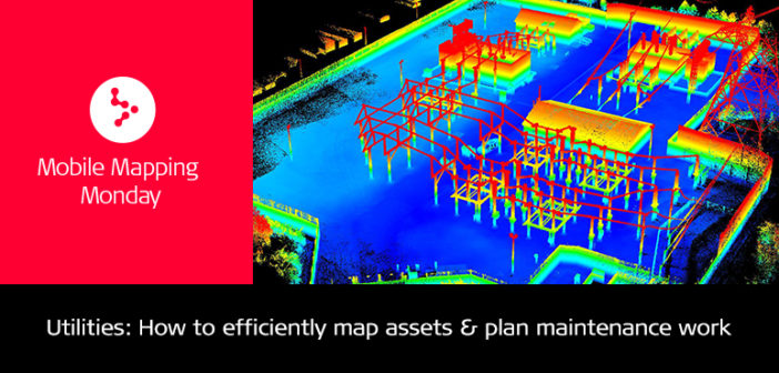
National Grid is a multinational electricity and gas utility company headquartered in Warwick, United Kingdom. In England and Wales, the company owns and maintains the high-voltage electricity transmission network. It connects power stations and major substations and ensures that electricity generated anywhere in these areas can be used to satisfy demand. In Britain, National Grid runs systems that deliver electricity to millions of people, businesses, and communities. They play a vital role in delivering electricity efficiently, reliably and safely.
More specifically, the network carries electricity from the generators to substations where the voltage is lowered and made ready for distribution. Most of National Grid network is overhead lines, underground cables, and above-ground substations. National Grid is responsible for balancing the system and managing generation output to make sure that it matches the demand throughout the day, and that voltage and frequency are kept within acceptable limits.
Reality capture in an electrical substation
A few months ago, I arranged a demonstration with National Grid at the electrical substation located at Willenhall, UK, to present the latest kinematic technology and its possible applications.

Electrical substation located at Willenhall (WV13 2LJ), UK
That day I had the chance to demonstrate the capabilities of the Leica Pegasus:Backpack in electrical substations and more precisely the efficiency that the wearable mobile mapping solution brings to the electrical business.

RGB coloured point cloud of the electrical substation
Listing the benefits
The Pegasus:Backpack allowed us do a complete reality capture in the electrical substation through 5 cameras and 2 laser scanners. The data acquisition with the Pegasus:Backpack was done in less than 10 minutes.

Point cloud coloured by elevation
The data would be used by multiple departments and for multiple purposes:
- Maintain archived data to prepare new developments or maintenance work
- Use the collected data (imagery and point cloud) to complete an asset extraction and to generate a geo-database with all assets managed by National Grid which need to be geo-located – this process is essential for efficient asset management
- Create plans for engineering works
- Monitor the condition of assets
The big advantage of the system is its productivity. With the Pegasus:Backpack, we capture large, difficult to access areas from a safe distance and faster than ever – as no terrestrial scan registration is needed.
The post-processing workflow to generate the deliverables (point cloud + imagery) in a pre-defined coordinate system is as fast as the acquisition workflow and needs approximately one minute of post-processing for each minute of acquisition time.

Point cloud coloured by elevation
The combination of LiDAR and imagery will guarantee a complete acquisition of the area and assets. The imagery it is not only used to extract coordinates to locate an asset but also to take measurements and colourise the point cloud.
The Pegasus:Backpack received positive feedback for its performance of mapping a substation and proved once again that it can provide maximum output in a minimum time frame. Contact us today at m3d@leica-geosystems.com to schedule your own demo.

Juan Madronal
Technical Specialist Mobile Mapping and 3D at Leica Geosystems AG


